We hated to leave Yellowstone National Park and the nearby Livingston, Montana area. Debbie and I have concluded that no matter how long you stay, its never enough time to do all the things that you want to do and see what you want to see. For those that are planning to visit, allow yourself ample time for driving distances within the park, be prepared for large crowds and minimal parking at the major sights that are on your bucket list.
Our primary Montana destination was Glacier National Park. There are multiple ways to get there from Yellowstone, we chose US HWY 89 which let us spend part of the day traveling through the Helena – Lewis & Clark National Forest. How can you get tired of seeing rolling hills, pastures and rambling streams along the way? Upon intersecting with HWY 87, we briefly stopped at Great Falls at Wal-Mart and the scenic overlook to see the mighty Missouri River crashing over Black Eagle Falls. We hopped on Interstate (15), then back on 89 to Browning which is somewhat the last city when visiting the eastern side of Glacier National Park. We stayed at St Mary KOA which was only minutes outside the entrance to the park. In the town of St. Mary, there are several RV parks, convenient stores, gas stations and lodging available but only ONE grocery store! If you plan on a lengthy stay in this area, encourage everyone to stock up before arrival, the St. Mary community does not have much to offer.
Our first day in the park was the initial trek up the “Going to the Sun” Road which was not yet open for the season. A brief stop at Rising Sun Picnic area allowed us to walk the dogs and witness our first Bear Warning signs, which would not be our last. The National Park is doing the best they can to inform the public to prevent catastrophic encounters with wildlife. People are ignorant and many that are injured, typically have Z-E-R-O common sense and a complete disregard for posted warnings. I think the only thing that is more disturbing is the people that come to these places to leave trash and don’t stay on trails.
Along the drive you will see Wild Goose Island, Baring Creek at Sunrift Gorge, and many other scenic turnouts to observe St. Mary Lake and the snow-capped peaks that shroud the shoreline. At the 12-mile marker, Jackson Glacier Overlook was the dead end until the road is completely opened.
Camping so close to the park, we went back to the RV and had lunch. Deb found a place to go off-roading. A five-mile journey to Cut Bank campground gave us the opportunity to drive through open range cattle fields, let the crazy beagle get his feet wet in the North Fork of the Cut Bank Creek as I cast a watchful eye in the area for “wildlife”.
Browning, MT is the headquarters for the Blackfeet Indian Reservation. We were there to capture a photo op and see what else there was to see on the outskirts of the National Park. A short drive down to East Glacier Village was our next jaunt where we found Dawson Waterfall on Railroad Creek.
We enjoyed another morning trip into the park amidst scattered showers which gave us some creative opportunities to catch the splendor of the park.
On our trip back from Jackson Glacier Overlook we encountered our first bear sighting! He created a brief traffic jam as we strolled down the middle of the road and crossed right in front of the jeep.
The afternoon ride took us to Many Glacier. A scenic drive that follows the Swiftcurrent Creek past Lake Sherburne to the Swiftcurrent falls that tumbled from Swiftcurrent Lake. A very popular area with the Many Glacier Lodge overlooking the lake and a large campground with many of the trail heads nearby.
On our last day at St Mary KOA, we were surprised to find out that the “Going to the Sun” road was opened for through traffic! This was an unforgettable adventure to Logan Pass and beyond to West Glacier village. There were spectacular stops along the way at Siyeh Bend and Lunch Creek. With rushing streams and snow-capped mountains and stormy skies, Deb and I had plentiful opportunities to take photos.
The Logan Pass visitor center was only five miles past Jackson Glacier Overlook, but the higher we went, the cloudier and foggier it became. By the time we got to Logan Pass at 6700 feet, it was raining, and visibility was virtually zero. As we began the decent to the western slope, visibility improved and when we passed the Weeping Wall, water was pouring off the cliffs onto the roadway. We continued to descend, with skies somewhat clearing, the heavy clouds lingering below the mountain peaks, the drive along Lake McDonald was incredible.
A pitstop at Eddies Café in Apgar village provided delicious take-out burgers but later realized we were charged for a Bloody Mary we NEVER got. After lunch we found a way to get down to the confluence of the Flathead River and McDonald Creek, unfortunately, the adventure was shortened by yet another afternoon downpour.
Our stay at East Glacier was over, but we were not finished with the park. Tally Lake Campground in the Kootenai National Forest was our next stop. It’s a small campground west of Whitefish. This was our new base-camp for expanding our West Glacier experience.
A return visit to West Glacier gave Deb and I to see the morning beauty of McDonald Lake, and the cascades and falls on McDonald Creek. The skies and mountains had a majestic beauty that was mind numbing.
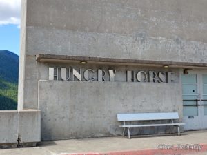
Near Glacier NP is the Hungry Horse Dam on the South Fork Flathead River. The Hungry Horse Reservoir is over 50 miles long and contains over 23,000 acres of recreational water. The dam is 564 feet in height and was the second highest concrete dam in the world at the time of its completion in 1953. VERY Hoover Dam like!
About a hundred miles west of Tally Lake on U.S. HWY 2 between Libby and Troy is the Kootenai Falls on the Kootenai River. This calm river surged first through China Rapids and then over Kootenai Falls, dropping 90 feet in less than a mile. The falls and surrounding area are considered sacred to the Kootenai Indians whose ancestors inhabited the region. Forest trails lead down to the Swinging Bridge and the upper falls. Crossing the swinging bridge was quite the experience. Deb’s spirit for adventure leapt into action and off she went. Me? Of course, I followed, but not with the same level of enthusiasm. I guess I realized I was not a fan of “Swinging bridges” over raging rivers. LOL.
Our return to Tally Lake was not a direct route! Instead of returning on US HWY 2, at Libbey, MT. we decided to take State Hwy 37 which followed the shoreline of Lake Koocanusa for over 50 miles. Libby Dam is a concrete dam on the Kootenai River. Lake Koocanusa was named for the treaty that was developed between the Kootenai Indians, the Canadian government and the U.S. government to build the dam and form the reservoir. We made a couple of stops along the way before we reached Rexford, where we were less than 10 miles from the Canadian border. In Eureka, MT we took US HWY 93 south back to the campground in the late afternoon skies.
The remote location of Tally Lake National Forest Campground was initially very appealing; a large campsite, Mountain lake, along a babbling brook but without internet & cell service, reported bear activity and abundant mosquitos it was a bit more “primitive” than we bargained for. Our time in Montana was coming to an end and we were anxious to be on our way to Spokane, Washington.


Leave a Reply