With the country under the siege of a pandemic and much of our travel plans back to Virginia altered, we made a major decision not to go to the East coast. While Deb and I were at Glacier we came up with an alternative travel route which would take us to a mix of places we have already been and some that will provide a new adventure.
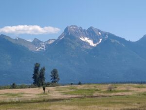

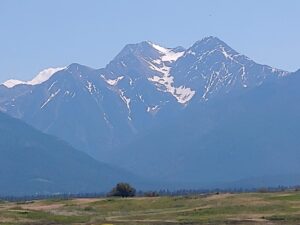
We left Coram, Montana and followed the shoreline of Flathead Lake on US Hwy 93 to Polson and on through Kicking Horse, Post Creek and St Ignatius. Off to the left we were passing Goat Peak, Mt. Calowahcan, McDonald & McLeod Peaks enroute to the Interstate at Missoula. A short drive on I-90E to the Garrison exit for US Hwy 12 where we would be following the Little Blackfoot River, the MacDonald Pass and down the slope into Helena.
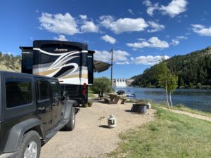
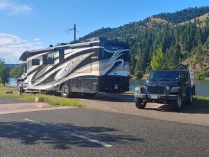
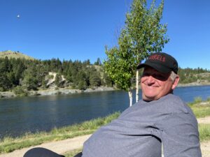


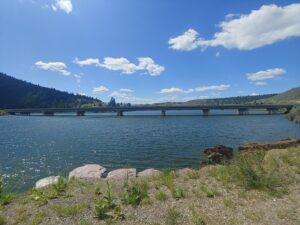

On our way up to Glacier we stayed here on the Missouri River for a few days and since we were heading east, it only made sense for a pit stop for a couple of days in order for us to see a little more of the area. Riverside Campground below the Canyon Ferry Dam is spectacular. Another waterfront site with a gorgeous view of the dam and spillway. I fished on the river without success, but it was nice to be able to feed them again. One of these days I will provide a long-winded, bitter rant about non-resident fishing license costs for old people but for now I will move on.
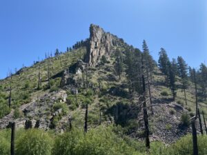
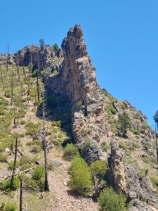

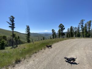
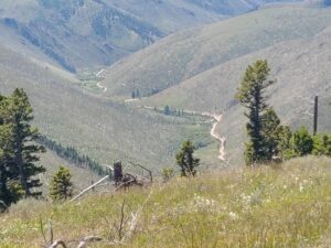


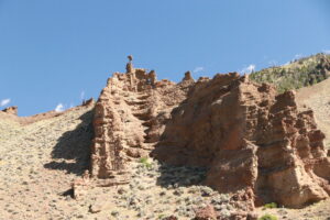
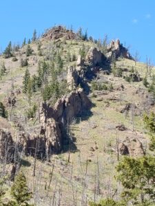
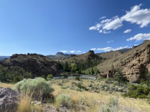
Lots of camping areas around Canyon Ferry Lake. Deb did a google map check to see if there were any canyons or off roads we could explore…. J-A-C-K-P-O-T… she found Magpie Gulch Road to sooth our off road addiction so we meandered on aimlessly for hours seeing geological features and climbed up to the mountain peaks over miles and miles of switchbacks. Atop nearby Hedges Peak, we decided to turn around and save the remainder of this adventure for another day, upon returning to Canyon Ferry Road, it was only a short drive to Hellgate Gulch Road.
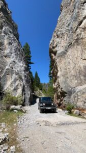
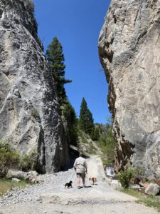
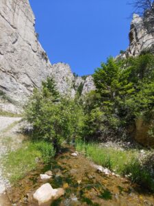
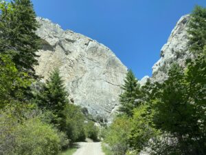
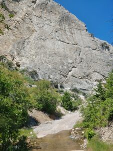
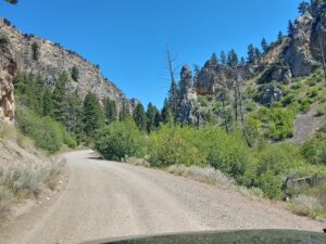
So, tell me, just how in the hell can you NOT want to go see what THAT is all about? It was a good day to have a Jeep. The canyon was rocky and narrow. The steep, sheer walls blocked the afternoon sun. We walked the dogs, let Zeus play in the creek for a bit then called it a day.
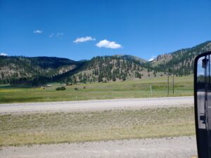
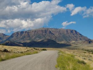
Soon we were back on the road and bound for Red Lodge, Montana. We exited off I-90 at Columbus and took a scenic route Hwy 78 through Absarokee and Roscoe and the green rolling hills into Red Lodge. This area is famous for its northeast entrance into Yellowstone National Park.
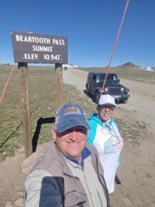
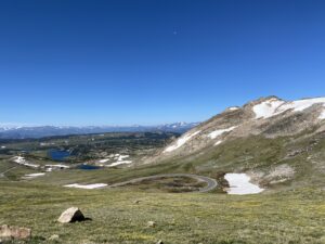
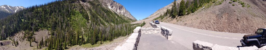
(Brief Geography lesson) The Beartooth Highway a is 68-mile byway winds its way through SW Montana and NW Wyoming and leads into Yellowstone National Park at its Northeast Entrance. It is the section of U.S. Route 212 between Red Lodge and Cooke City, Montana. It provides steep zigzags and switchbacks, along the Montana-Wyoming border to the 10,947 ft high Beartooth Pass in Wyoming. The approximate elevation rise is from 5,200 ft to 10,947 ft. in 12 miles… it clearly exceeds any and all descriptive superlatives.


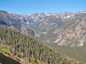

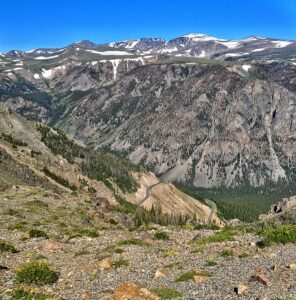
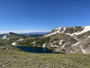
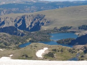
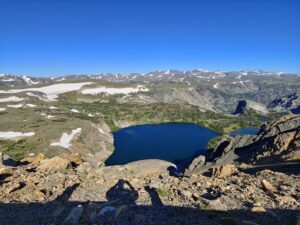
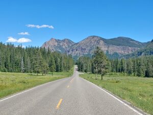
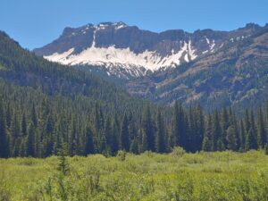
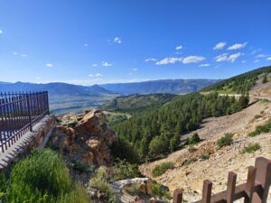
An early morning departure, we were off to Beartooth Hwy and it did not disappoint. Beautiful forests and campgrounds dotted the roadway before we began scaling the switchbacks to the summit. Overlooks and vista views were mind-numbingly awesome with deep blue lakes below and snow-covered peaks on the nearby horizon. With good reason it has been called “the most beautiful drive in America,” by late CBS correspondent Charles Kuralt. At some point in time Deb and I will provide our own Top Ten Scenic Drives and a bonus list of our 10 favorite Off-Road adventures.
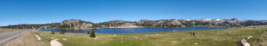
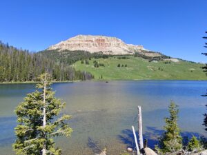

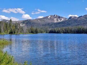
Coming down was much easier than going up. Driving past Frozen Lake, Long Lake, Island Lake and Beartooth Lake just to name the ones that are right on the highway. A snack stop at Top of the World Store to get the Obligatory Sticker “I survived the Beartooth Highway – 10947 feet” and we were on to Yellowstone National Park.

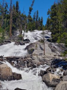
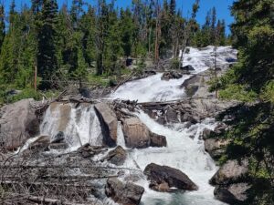
Of course, we had to detour off the main road to see Lily Lake and the Rock Island Butte off in the distance, then a short stop at Crazy Creek Falls to walk the puppies and validate (via a short hike), how these falls had gotten their namesake.

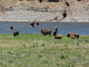
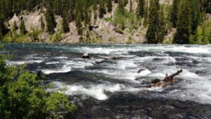
Our destination in the park was Tower Junction. Due to a landslide on the Grand Loop Road, somewhere between there and Canyon Village we would NOT be able to loop back out through the East Gate of the park. The drive on US Hwy 212 or NE Entrance Road was yet another OMG, WTF, Holy Cow drive along the Soda Butte Creek and then the Lamar River. Lamar Valley had the largest concentration of buffalo that we had ever seen. Total number, easily in the thousands, with herds in the hundreds throughout the valley.
Somewhat disappointed we had to return the way we had just came, it just meant we got to see all those buffalo again. A pit stop in Cooke City for some huckleberry fudge and Montana’s version of a caramel turtle.


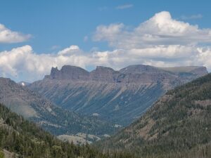
Our return trip did not require us to again challenge the Beartooth Highway. Instead we took SR 296, the scenic Saint Joseph Highway. It is a 46-mile-long journey and follows the route taken by Chief Joseph as he led the Nez Perce Indians out of Yellowstone National Park and into Montana in 1877. This was a gem that we knew little about and we were overwhelmed at the canyon & mountain views and the glimpses of the Clarks Fork Yellowstone River below. Be sure to stop at Sunlight Bridge and take a walk out to see gorge floor, 285 feet below. This was another scenic stop that we weren’t aware of. With afternoon skies slipping away, we still had to get through the Absaroka Range via Dead Indian Pass. The switchbacks and overlooks provided even more spectacular views before we descended to the intersection of SR 120 where we headed north to Belfry then west on SR 308 back to Red Lodge.
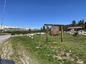
After a couple of days lounging around the campground and Red Lodge, we were off to complete one of our ALWAYSONDAFLY travel goals; to go through EVERY entrance of Yellowstone Park.
| Gate | Date |
| South Entrance – Canyon Village | 22-Aug-18 |
| South Entrance – Old Faithful | 18-Jun-20 |
| North Entrance – Tower Junction | 15-Jun-19 |
| West Entrance – Loop Teton Pass | 21-Aug-19 |
| West Entrance – Prismatic Spring | 20-Jun-20 |
| N/E Entrance – Beartooth Hwy | 11-Jul-20 |
| East Entrance – Shoshone NF | 14-Jul-20 |
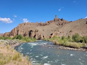
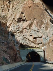

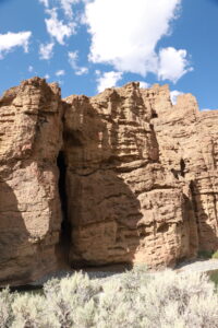
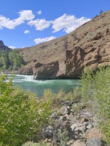
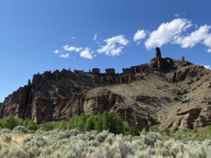

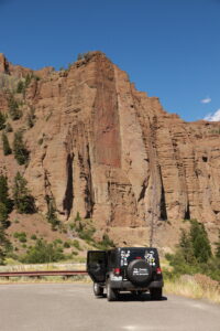
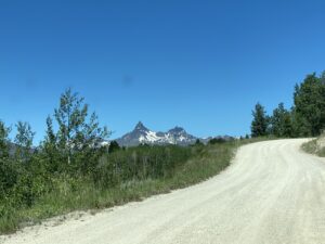
A sixty-mile drive on SR 308 to Belfry and south on SR 72 to Cody, Wyoming was necessary before we could begin our adventure into the Shoshone National Forest and the East entrance to the park. US Hwy 14 (North Fork Highway) follows the Shoshone River past Buffalo Bill Dam. Did you know that this was the first concrete arch dam in the world built in 1910 for hydroelectric power, irrigation and recreation? The route continues to follow the shoreline of the Buffalo Bill Reservoir, past the iconic Smith Mansion and the beginning of the Absaroka Mountains. The geological changes along the way were amazing. Dikes were present all along the highway. We have seen this feature before, and it continues to amaze. The alterations and changes in colors were visible from the road and we made several stops along the way to enjoy these unique rock formations.

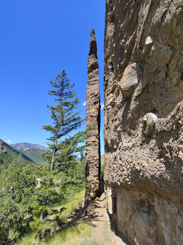
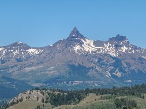
Be sure to stop and see Chimney Rock. It is right on the roadside; you cannot miss it. Near the Pahaska Tepee Resort you lose the Shoshone River and begin to follow the Middle Creek until you reach Sylvan Pass. Quite a spectacular view of the highway making its way through the mountains.
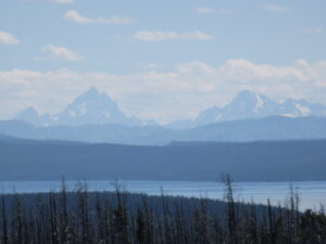
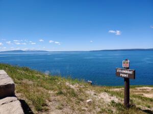
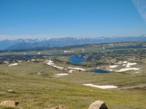
As you begin the descent past Top Notch and Avalanche Peaks, Yellowstone Lake becomes visible, and we were fortunate that it was clear enough to get a distant glimpse of the Grand Tetons to the south. Steamboat Point was the first stop where the smell of sulfuric gas was evident as we seen mini hot springs along the lake shoreline.
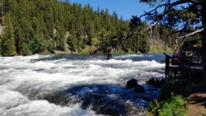

A strategic pause at Fishing Bridge Visitor Center allowed us to give the puppies a much-needed walk and a chance to see what was open for business.. Pretty slim pickins, pandemic had everything closed but the gas station and general store. We continued our journey up the Grand Loop Road to see what wildlife was out and about along the Yellowstone River. A brief stop to see LeHardy’s Rapids, then a short stay at Coldwater Geyser to observe some buffalo grazing, then a much-needed picnic at Otter Creek, on the banks of the Yellowstone River.
We did not venture into Canyon Visitor Center as we were not crazy about mingling with the mobs. Upper Falls View, Artist Point were also slammed and there was little evidence of anyone wearing masks or social distancing so we decided this stuff would still be here when we visit at some point in the future.
This meant the end of the road for this day’s adventure, so we did an about face and retraced our route back to Fishing Bridge, through Sylvan Pass, out the East entrance and got to re experience the geological marvels along the Shoshone River all the way back to Cody.
We always try to do loop routes whenever possible to take in as much as we can when visiting an area. In and Outs are not a bad thing, though. Its always a surprise to see what you missed the first time around and typically the change in the time of day provides photo ops you did not have in the morning hours.
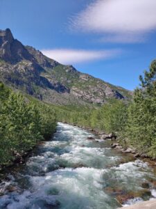
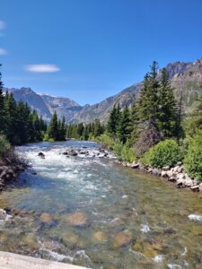
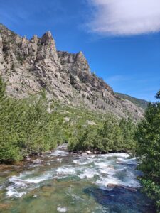
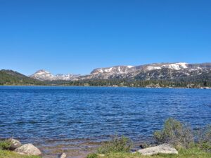
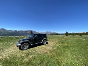
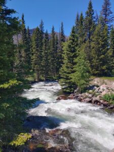
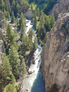
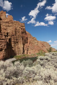
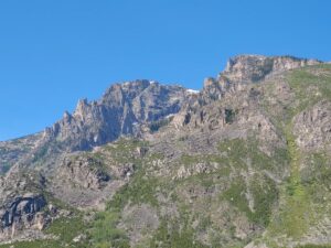
Our last adventure around Red Lodge was a back road adventure up to East Rosebud Lake. A leisure drive through the green rolling hills on SR 78 to Roscoe, then we drove up East Rosebud Road for some off-road fun. We stopped at the Sand Dunes Picnic site for a puppy stretch and get up close to the East Rosebud Creek. The closer we got to our destination, the canyon narrowed, and the mountain peaks appeared taller and even more majestic. The creek’s cascades and rocky bottom provided many chances for “Photo-Ops”.
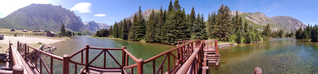

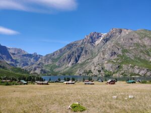
The village of Alpine covers the lake shoreline. It is a private lakefront community, but we were able to stop at the boat ramp, walk out on the footbridge and see how beautiful the lake, mountains and trees that bordered the shoreline. The primitive East Rosebud Campground is nestled near the lakeshore, but we would never consider punishing our RV to get there, besides, it can only handle rigs up to twenty feet and seemed much more suitable for tent camping.
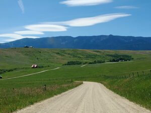
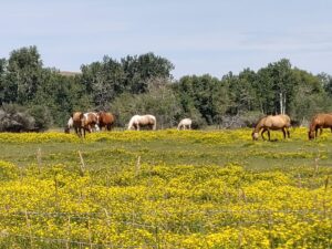
On our way out, we did swing through Jimmy Joe Campground to give the puppies one last stretch. Another nice little campground with sites right on the East Rosebud Creek. Our return route took us to a rural crossroad called Luther. Found a field full of flowers and horses. Upper Luther Road took us back to SR 78 and we made it safely back to Red Lodge.
What an amazing area to explore. Beartooth Pass, St. Joseph Scenic highway, two different ways to get to Yellowstone NP and an opportunity to see what Cody, Wyoming is all about. Now, it is time to get back on the road. The Big Horn Mountains of Wyoming are calling.
Leave a Reply