Welcome back to “ALWAYSONTHEFLY”. Deb and I made the decision early in our planning process that we were going to do something different this year. We spent the summer in New Mexico, using Kirtland Air Force Base in Albuquerque as a launch pad for our travels. This season’s blogs will capture the daily adventures we experienced on our summer in New Mexico.
When we left Tucson April 1, our first layover was just up the road to Phoenix for a nice short stay at the new Famcamp at Luke Air Force Base. Staying there gave us some opportunities to expand the meandering that we have a hard time pulling off in a day trip from Tucson without the dogs. The landscape in the Phoenix area is intriguing.. various mountain ranges nearby, seasonal streams that are nearly tapped out for irrigation, and excellent parks with abundant recreation opportunities.
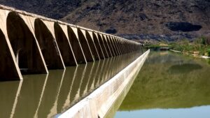


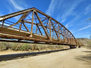

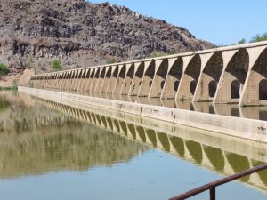
A piece of highway history is Southwest of town, The Gillespie Bridge and Dam is a pretty cool Truss Bridge that spans the Gila River. It is one of the few surviving multiple-span steel through truss bridges in Arizona
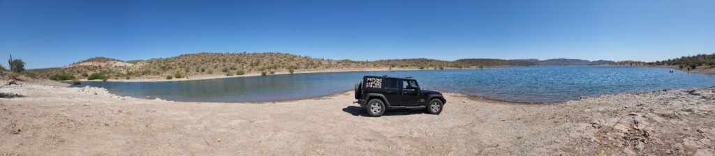
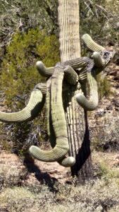
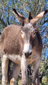
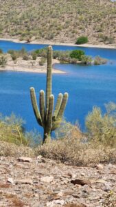
Northwest of Phoenix lies Lake Pleasant Recreation area. A beautiful park that has several nice campgrounds, abundant hiking, kayaking, fishing, and even wild donkeys and saguaros on the lakeside. Deb and I both agreed that this would be a great place to beat the heat if we come back through this area.

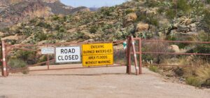
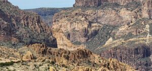
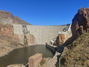
East of Phoenix, near the Superstition Mountains lies the Salt River canyon. The Apache Trail follows it up to Roosevelt Lake & Dam. Unfortunately, there was a significant washout and landslide a few years ago that has severed the thoroughfare.
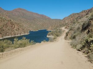


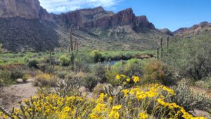
There are many scenic points, overlooking the river cliffs and on both ends of the route. Very suitable for some off-road adventuring but surprisingly many enjoy camping in this remote area.
Of course, we have found a “foodie” paradise at Romanelli’s Italian deli & Bakery, not only do they have an excellent hot & cold sandwich selection, but the charcuterie options are also top notch, with many Italian imports available, such as soppressata, prosciutto, and mortadella. Their fresh homemade Italian sausage is killer, and they market their own brand of pasta sauces as well. The ringer is the Italian pastries! Deb discovered Sfogliatella, (Italian pronunciation: [sfoʎʎaˈtɛlla]!!! I have a much less refined palate and am easily satisfied with a lemon bar, éclair, or a cannoli. Regardless, we never leave without lunch, groceries, and pastries to go and this place has become a must stop any time we visit Phoenix.
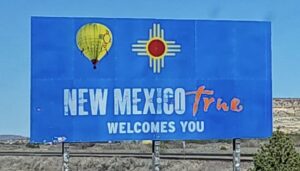
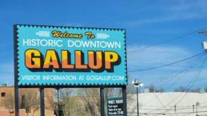
Next stop, Gallup New Mexico. We have taken the trek up the hill on I-17 to Flagstaff on a previous journey, so we decided to take a different route. I-17S and I-10E got us through downtown and to the eastern outskirts of the city, then SR202 gets you past Arizona State University to the Mesa Grande exit on SR87 North (Beeline Highway) to Payson, Arizona. Our northeastern route continued on SR260 through the mountains and evergreens to Heber-Overgaard where SR 277/377/77 finally got us back to the East bound I-40 in Holbrook. Here, we got a glimpse of the roadside remnants of the famous Route 66. With blue skies and abundant sunshine, we drove past the Petrified Forest & Painted Desert National Park. A Welcome to New Mexico sign greeted us and soon we were at our destination of Gallup.
Nearby Gallup is The Navajo Nation which was severely impacted by the COVID epidemic. The reservations and pueblos for all indigenous tribes were closed to the public to minimize the impacts of outsiders. Canyon de Chelly National Park, El Morro & El Malpais National Monument were not open in our previous attempts to visit, this year we were determined to seize the opportunity to go.
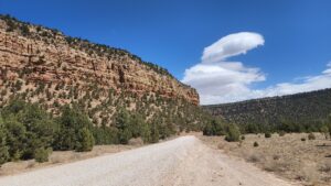
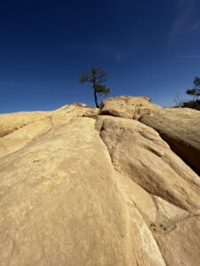
El Morro Monument is a short scenic drive south and east of Gallup about 60 miles. With only a few distractions along the way, we were there in a couple of hours.
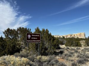
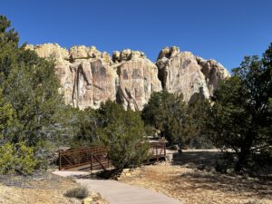
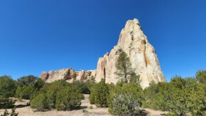
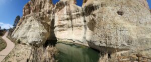
The El Morro Visitor Center was well staffed with informative rangers and volunteers. Trails were spotless and information markers dotted the entire ½ mile paved loop. The Pool at El Morro has been drawing people to its banks for hundreds of years. Ancestral Puebloans, Spanish explorers, and American emigrants have benefitted from its remote location.
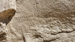

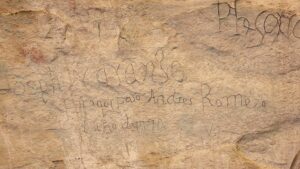
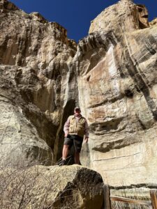
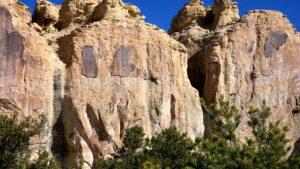
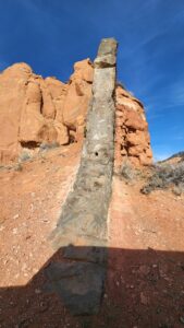
Inscription Rock is just one reason to put El Morro National Monument on your must-see list. The cliff wall inscriptions captured the visits by many travelers.
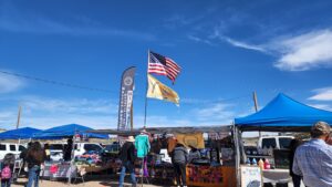
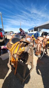
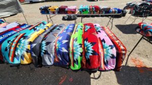
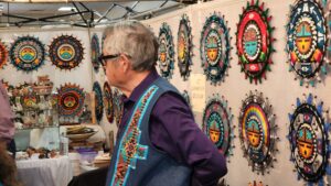
During our short stay in Gallup, we visited the local flea market on Saturday. Plenty of fresh fry bread and pastries available as well as street tacos. Some unbelievable craftmanship was displayed in the jewelry, wood carving, and pottery booths.

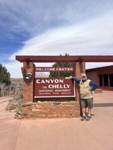

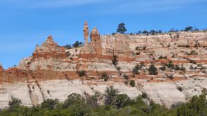
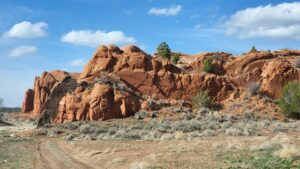
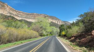
Canyon de Chelly National Monument was the primary purpose of our stay in Gallup. With the RV parked, we took the Jeep on a 90 mile drive up to Chinle, Arizona. Amidst the Navajo Nation, we passed through Yah-Ta-Hey, Window Rock, Ganado, past the Hubbell Trading Post National Historic Site and on to US HWY 191 up to Chinle. Canyon de Chelly pronounced “canyon d’shay,” is one of the longest continuously inhabited landscapes in North America, preserving the ruins of the Ancestral Puebloans (Anasazi) to the Navajo. The name “Chelly” is a Spanish borrowing of the Navajo word Tséyiʼ, which means “canyon.” It was established as a National Monument in April 1931. Canyon de Chelly is entirely owned by the Navajo Tribal Trust of the Navajo Nation. It is the only National Park Service unit that is owned and cooperatively managed in this manner. About 40 Navajo families still live in the park.
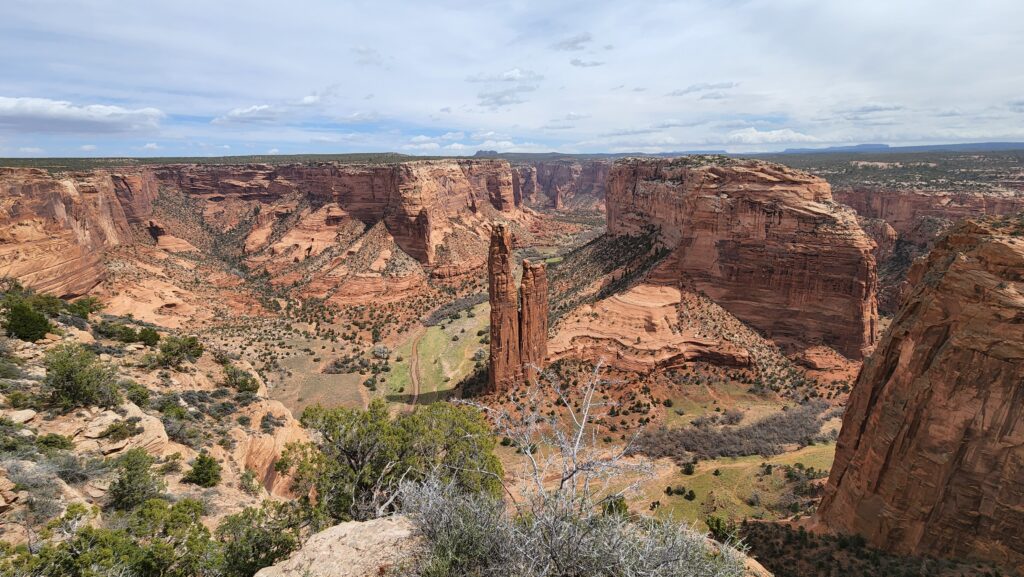
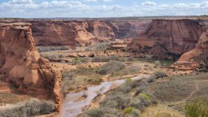
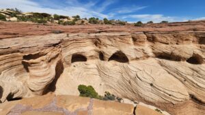
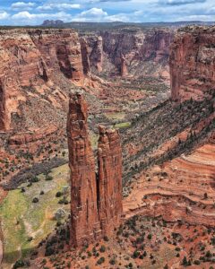
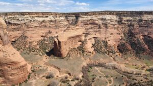
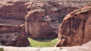
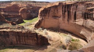
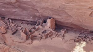
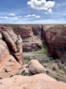
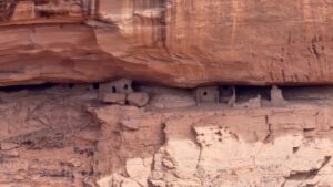
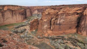
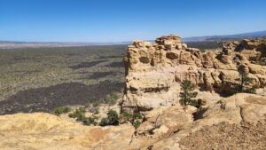
The scenic overlooks of Canyon de Chelly are unmatched anywhere else in the country. Sheer red rock cliffs in many areas are easily over 750 feet allowing you to look straight down in the green canyon below. Tunnel Overlook, Tsegi Overlook, Junction Overlook – (Canyon Del Muerto), White House Overlook, Sliding House Overlook, Face Rock Overlook and the Grandaddy,,,, Spider Rock. These are all on one scenic south rim Drive that we highly recommend taking mid-morning if possible. Not only the light is right, its early enough in the day you won’t be discouraged by the heat. Our visit was in April, the day we were at the park we had wind gusts in excess of 50MPH blasting up the 750-foot canyon walls. There are also other scenic overlooks on the north rim accessed off of county road 64.
 You grow up reading the history books on the West, that Kit Carson was a pioneer, a trapper, a trail blazer, and a key figure in how the west was won. Now…. some 60 years later you discover that Colonel Kit Carson led a campaign against the Navajo, he terrorized the Navajo – burning crops, destroying villages, and slaughtering livestock, which ultimately resulted in the removal of 8,000 Navajo to new lands in eastern New Mexico. The Navajo people were forced to walk the 300 miles from Canyon de Chelly to Fort Sumner, New Mexico. An estimated 300 Navajo died on this journey, known as “The Long Walk.” In 1865 Carson was given a commission as brigadier general and cited for gallantry and distinguished service. Later, we will share our experience when we visited the Fort Sumner Historic Site/Bosque Redondo Memorial.
Our return trip to Gallup was a different route. After the scenic drive along the North rim, the road continued east to Tsaile and the intersection of County Road 12. Be advised…some mapping services show these roads as Indian Nation Roads…!
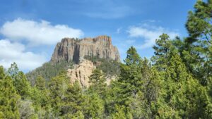
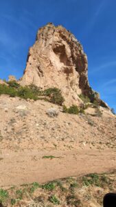
Southbound now, through Sehili where we got sidetracked to see how close we could get to an un-named “Devils Tower-like” peak. Past Wheatfields, across the state line into New Mexico, through the village of Navajo where we discovered another geologic landmark that was not marked and back to Window Rock where the Navajo Nation Museum is located. We had to save that for another visit… After all,…gotta leave something on the “bucketlist”. Back to Gallup after a full day of sensory overload at Canyon de Chelly.
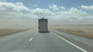

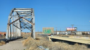
With a wintry blast in the forecast and some sick puppies we decided to cut our stay in Gallup and head to Albuquerque. The drive from Gallup to ALBQ is only 153 miles but with 40-50 MPH crosswinds, we were in for a helluva Roadtrip. Church Rock will have to wait for another visit. Interesting lava flows dotted the landscape along the Interstate through Grants, we knew we’d be back this way to visit El Malpais National Monument and hopefully to also visit Acoma Pueblo if open to the public. On the western outskirts of ALBQ we went past the famous Route 66 Rio Puerco Bridge and paralleled Route 66 for a few miles. Little did we know at this time how much of the historic highway we would see this summer.
With Kirtland AFB FAMCAMP as a homebase for our traveling adventures, over the next few weeks, we will go and see some of our favorite places, retake some favorite drives but also mix in some new experiences and day trips. Some were hampered by two disastrous fires that charred over 500,000 acres. Deb and I have been fortunate to see so much more of what New Mexico has to offer and this year, experience the monsoon season…
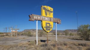
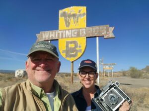
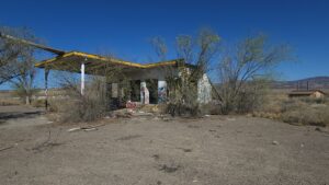
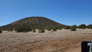
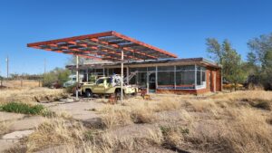
Our first NEW adventure was a drive back to El Malpais National Monument. With abundant blue skies, we headed off on I-40W to exit 89, State Road 117, but not before a brief stop at the ruins of an old Whiting Bros Gas Station.
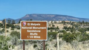
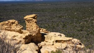

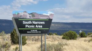
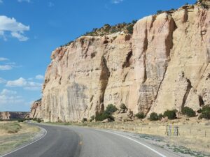
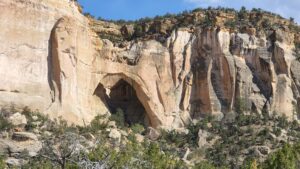
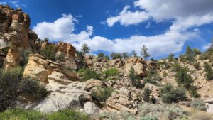

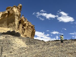
Sandstone Bluffs was the first overlook that was high above vast lava fields. Quite a spectacle! We entered the Cebolla Wilderness area, and a stretch of road called the “Narrows” because of its proximity to the towering cliffs on one side of the road and the once flowing lava fields on the other. Deb and I found that the Narrows Picnic area was an ideal spot for lunch and a dog walk AND we had the place to ourselves!!
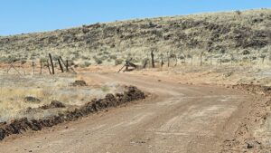
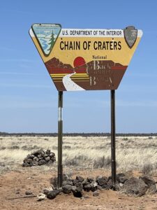
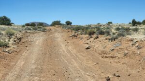
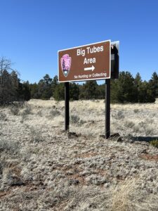
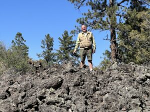
Our travels continued down the highway past Lava Falls Trail to SR 42. The Chain of Craters Scenic Byway was open and recently graded (allegedly). Its paramount that you check in with local rangers to find out road conditions. During rainy weather the road can be impassable. The 33-mile gravel road brings you to a chain of 25 cinder cones emerging from weak spots in the earth’s crust and skirts the lava field right up past Bandera Crater, we successfully navigated the off-road adventure without incident, hopped on Ice Cave Highway SR 53 safely back to the Interstate and ALBQ.
Other day trips and events during this April/May stay was a day trip to Jemez Pueblo & Jemez Springs on SR 4. This day our trip was cut short because the road was closed due to a wildfire that was still out of control and skipping over the highway and getting perilously close to Valles Caldera National Preserve. It was interesting to see the contrast in color from our previous visits. The cottonwoods along the Jemez River were a brilliant green. We had a similar experience in an attempt to drive up Pecos Canyon, all of Santa Fe National Forest was closed to the public due another raging wildfire. ALL National Forest roads were closed throughout New Mexico because of the wildfires and the high risk for more.

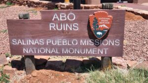
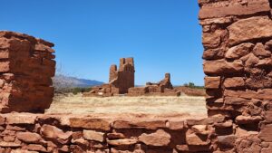
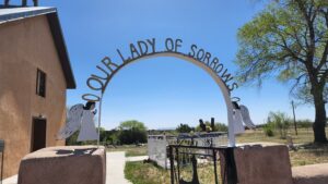
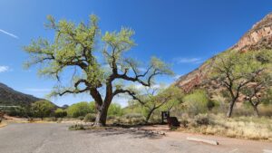
Southeast of ALBQ lies the Salt Missions Trail Scenic Byway which traverses the heart of New Mexico from the mountains to the plains meanders through many small towns and villages that have country chapels or missions. The three Pueblo ruins of the Salinas Pueblo Missions National Monument are also near Mountainair which is on US Hwy 60.
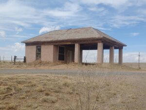
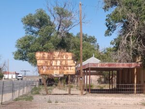
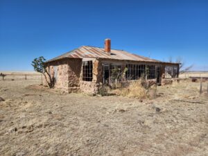
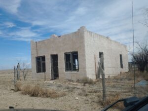
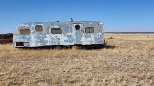
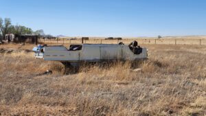
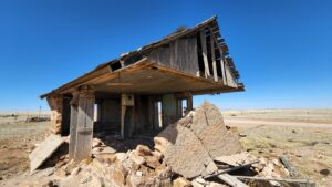
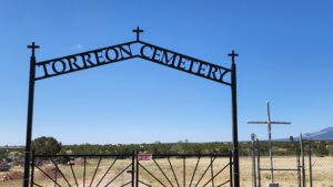
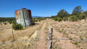
We’ve wandered all over this territory following backroads to the railroad to catch a glimpse of the past to find old ghost towns and abandoned homesteads. Willard, Negra, Encino, and Vaughn were all bustling railroad communities that thrived in the day of the steam locomotives. When those massive steam engines were replaced by diesel, the towns all dried up as the need for water stops were no longer necessary. Along with the change in the railroad communities, this area once was an agriculture paradise but as the climate changed and the rivers and streams dried up, today, little remains from their days of glory.
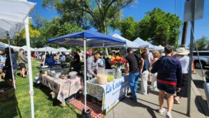
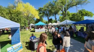
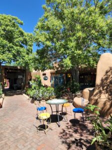

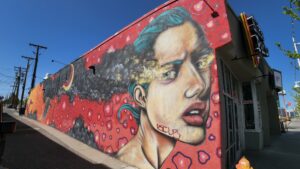
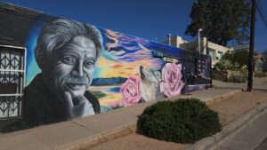
The city of Albuquerque has much to see and do. During this stay we enjoyed the Downtown Growers’ Market at Robinson Park. The fairgrounds hosted a Flea Market on the weekends. Central Ave (Business Route 66) still has neon signage from motels and the street art and murals are plentiful.
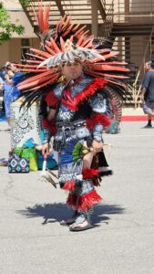
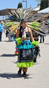
Albuquerque hosts the “Gathering of Nations”. It’s the largest pow-wow in the United States and North America. Colorful Indigenous Dancing, arts and crafts, abundant food vendors and the day was capped off with a horse parade with participants wearing their tribal garb.
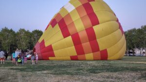
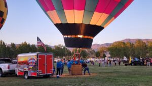

We enjoyed a Nightglow right on Kirtland Air Force Base… Hot Air Balloons are inflated, tethered, and provided quite an evening spectacle. At least a dozen showed up however the winds discouraged many participants. Fortunately, the few that did put on quite a show.
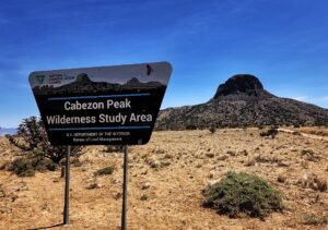
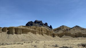

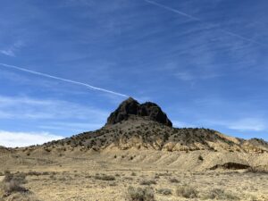

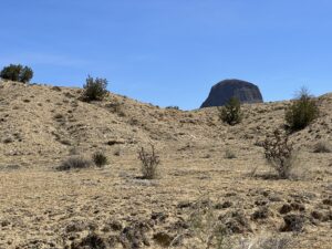
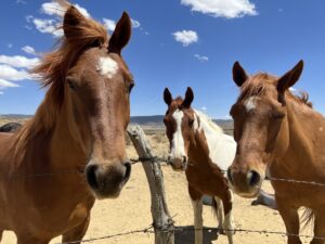
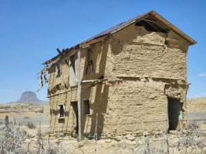
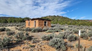
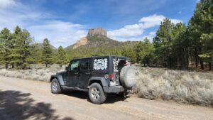
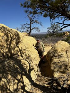
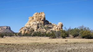
The last daytrip (for now) was a trek out to Cabezon Peak which about 80 miles northwest of Albuquerque off into the desert wilderness off US Hwy 550. This is not the first time we have visited this area. The abandoned buildings, rural Mission, Pueblo Ruins, wilderness study areas, the harsh environment and the geological diversity provides so much to discover the new and appreciate vast beauty and harshness of the desert.

This is our first chapter of the Land of Enchantment – 2022. Look forward to sharing the next leg of our summer journey, soon.
Please enjoy the following additions to our Flickr Gallery.
Canyon de Chelly https://www.flickr.com/photos/143856759@N06/sets/72177720298208171/
El Morro https://www.flickr.com/photos/143856759@N06/sets/72177720298959800/
El Malpais https://www.flickr.com/photos/143856759@N06/sets/72177720300307862/
GOOGLE MAPS BONUS – New Mexico Churches & Missions https://www.google.com/maps/d/edit?mid=1WbLoKgI_YQZcWC7aqywTnLAPN-kub2Y&ll=34.716673776934755%2C-106.10581454999999&z=7.
Leave a Reply